Use a Coordinate Reference System (CRS) in SketchUp's Add Location to geolocate your model. A CRS represents real-world locations using Easting and Northing coordinates for precise positioning.
CRS in Add Location
Before you use a CRS in Add Location, check these requirements and limits:
- Check your project's EPSG code to identify its coordinate system, or have a CRS calibration file ready.
- Your CRS determines the coordinate units your project uses.
- You can't adjust True North when you use a CRS.
- After you geolocate your model with a CRS, you can't change its CRS or switch to another geolocation method. To use a different CRS, clear the model's geolocation data, then add the new CRS in Add Location.
- To use CRS, you need a SketchUp Pro subscription, one of the Pro subscription options, or a Studio subscription.
To geolocate your model with a CRS:
- In Add Location, choose Coordinate Reference System (CRS) from the dropdown under Method.
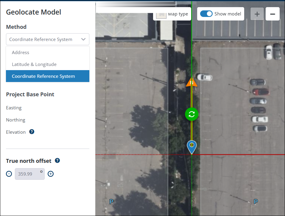
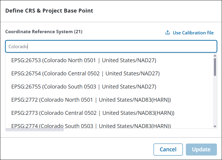
- Select the CRS your project uses. If needed, search by EPSG code or name. Add Location uses the selected CRS's units for your project coordinates.
- Enter the Easting and Northing coordinates for your Project Base Point. The Project Base Point links your model to its location within the CRS.
- (Optional) Switch the elevation toggle off to change the elevation manually. Add Location automatically retrieves the elevation associated with your CRS.
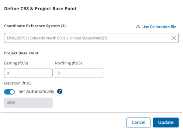
- Click Update to geolocate your model with the selected CRS.
- Review the information to confirm that the CRS and Project Base Point are correct.
CRS interoperability
These limits apply when you import or export CRS content:
- SketchUp doesn't recognise or use CRS information in imported files. Check the imported content's position before you use it in your project.
- The .
skpformat keeps your model's CRS information as IFC data. - Exports in any other format don't keep CRS metadata.
- Results may vary with third-party extensions. Always check the position of geolocated content when you use an extension that uses SketchUp's geolocation data.